Web GIS with MapGuide Opensource 1.2

I found that the simple and low cost way to setup, produce, run and maintain a Web Geographic Information System (GIS) is by using MapGuide Opensource (server) and Autodesk MapGuide Studio (Author).

Screen shot Note: The spatial data is based on esri shape file (shp) and automatically transform into sdf (autodesk spatial data file) for better performance. The Image layer is from NASA.

The spatial layer can also easily join with other data source such as SQL Server, Oracle, MySQl , PostgreSQL , etc

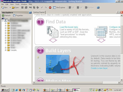
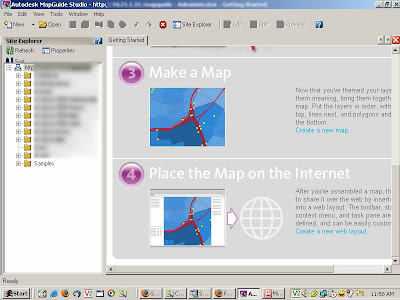
Here’s the screen shots, from authoring until publishing:

1. Find Data and Build Layers
2.Make Map and Place The Map on the Internet
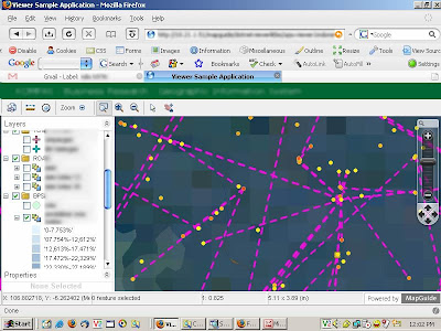
3.Line feature, it connect all the dot.
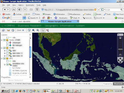
4.It quickly load(show) millions of polygon shapes

5. image from NASA and transparant layer
6. Buffer
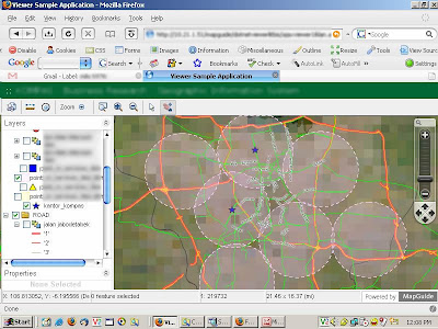
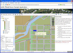
7. An Image from a click on a location, using simple concat script

The Web GIS application is runnning on windows server 2003 operating system, dot net 2.0 framework , mapguide opensource 1.2 and Autodesk MapGuide Studio
MapGuide Open Source (MGOS)

I always looking for free web gis server with dotnet framework capabilities. Mostly everything that related with dotnet came with a charge. Recently i found that autodesk start their web gis opensource project, the MapGuide Open Source Project (MGOS). Surely it can run on dotnet framework and it’s free.

MapGuide Open Source is a web-based platform that enables users to quickly develop and deploy web mapping applications and geospatial web services. MapGuide features an interactive viewer that includes support for feature selection, property inspection, map tips, and operations such as buffer, select within, and measure. MapGuide includes an XML database for managing content, and supports most popular geospatial file formats, databases, and standards. MapGuide can be deployed on Linux or Windows, supports Apache and IIS web servers, and offers extensive PHP, .NET, Java, and JavaScript APIs for application development. MapGuide Open Source is licensed under the LGPL..

Free Download

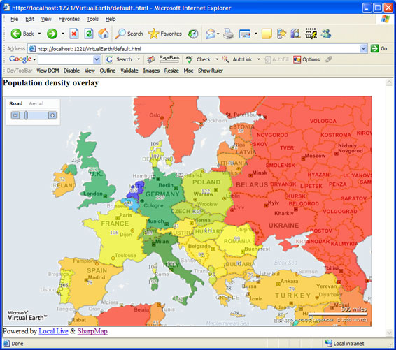
Sharpmap

One of my favorite geographic Information System (gis) web server is Sharpmap. It runs on dotnet 2.0 and using ASP.NET(C#) language. I like Sharmap, because it’s open source and free . The web server it self didn’t need any additional software/component to install. Just pure dotnetframework (v.2.0). So it can be easily deploy on common IIS web server equip with dotnetframeork.
Sadly, Morten which is the main developer of sharpmap had to decide not to involve on the project anymore, just when the project began to bloom. Morten working on ESRI California at the ADF Team now.

Free Download

MapGuide Open Source

I always looking for free web gis server with dotnet framework capabilities. Mostly everything that related with dotnet came with a charge. Recently i found that autodesk start their web gis opensource project, the MapGuide Open Source Project (MGOS). Surely it can run on dotnet framework and it’s free.

MapGuide Open Source is a web-based platform that enables users to quickly develop and deploy web mapping applications and geospatial web services. MapGuide features an interactive viewer that includes support for feature selection, property inspection, map tips, and operations such as buffer, select within, and measure. MapGuide includes an XML database for managing content, and supports most popular geospatial file formats, databases, and standards. MapGuide can be deployed on Linux or Windows, supports Apache and IIS web servers, and offers extensive PHP, .NET, Java, and JavaScript APIs for application development. MapGuide Open Source is licensed under the LGPL..

Free Download

Sharpmap

One of my favorite geographic Information System (gis) web server is Sharpmap. It runs on dotnet 2.0 and using ASP.NET(C#) language. I like Sharmap, because it’s open source and free . The web server it self didn’t need any additional software/component to install. Just pure dotnetframework (v.2.0). So it can be easily deploy on common IIS web server equip with dotnetframeork.
Sadly, Morten which is the main developer of sharpmap had to decide not to involve on the project anymore, just when the project began to bloom. Morten working on ESRI California at the ADF Team now.

Free Download

Sharpmap, a simple dotnet gis

Copyright by sharpgis.netAplikasi web gis saat ini memiliki perkembangan yang pesat. Awareness dari para developer di bidang (Information and Communication Technology) ICT untuk menjadikan peta sebagai bagian dari bagian dari aplikasi map service juga menunjukkan hasil yang menakjubkan. Google Maps , Microsoft local live dan Yahoo Maps merupakan contoh map service yang sangat berhasil. Bagi para developer sangatlah mudah melakukan mashup dengan map service tersebut. Membangun sendiri map service atau kita sebut saja web gis juga tidaklah sulit.

MapServer – UMN Map Server mungkin aplikasi yang paling populer dikalangan developer opensource. It’s free(baca:gratis) and it’s opensource. Permasalahannya saya tidak menggunakan bahasa PHP dan juga dibutuhkan setting khusus (install aplikasi) pada hosting linux tersebut yang biasanya tidak memungkinkan/diijinkan oleh administrator share hosting linux. Bagi developer dotnet seperti saya sangatlah sulit mencari component atau engine yang gratis dan sifatnya opensource bagi apikasi web gis yang ingin saya bangun apalagi ingin di jalankan di share hosting. Kalaupun ada pastinya bisa sangat mahal karena harus menggunakan ArcGIS Framework atau MapExtreme dan pastinya tidak ada (belum ketemu) share hosting yag menyidiakan fitur tersebut. :-p

Continue reading Sharpmap, a simple dotnet gis

ESRI South Asia User Conference

Pada tanggal 6-8 September 2006, ESRI South asia mengadakan user conference yang ke 13 di Subang malaysia. Dalam conference tersebut ada beberapa perkembangan menarik tentang teknologi mapping yang dapat kita cermati bersama.

ArcGIS Server 9.2

Pada user conference kali ini sangat terasa adanya ‘urgensi’ dari pihak ESRI untuk memperkenalkan fitur pada ArcGIS Server 9.2 yang pada saat tersebut masih berstatus ‘Release Candidate’. Wajar saja mengingat satu tahun terakhir ini beberapa perusahaan IT dunia sangat gencar melakukan inovasi dalam teknologi mapping. Contoh nyata tersebut dapat kita lihat pada Google Earth Versi 4 (beta) dan API baru Windows Local Live.

Continue reading ESRI South Asia User Conference

GIS team

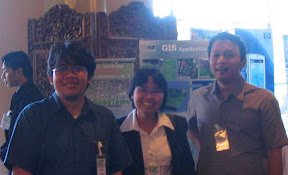
Nah ini dia team gis bisnis kompas di ESRI 12th south asia user confrences…
sedang bersenang-senang setelah setahun lebih di tengah kota yang super macet, tapi enaknya di gama banyak jualan nasi campur heheheheh…….
makanya pada jadi bulet-bulet kayak bola tenis.gis kompas powered by ESRI